Our original plans for the last chance to snowshoe with Dan before his second kid arrived changed almost as soon as they had been made. We started with a route around Lake Easton, but that was deemed too far to drive. On the west side of the Pass we toyed with Franklin Falls, but there probably wasn't much snow there. In the end we chose to go to the Kachess Sno-Park and see what there was to be seen.
The drive was really fast. There was no snow on the freeway and no traffic to speak of. Once off the exit the road to the sno-park was freshly plowed and provided good traction. However, we had gotten a really late start so it was just after 9pm before we were parked across from a closed Road #4936.
The maps showed #4936 climbing up the southeast corner of Keechelus Ridge with a potentially bald plateau at about 3,180 feet or roughly 800 feet above the road. If it was indeed bald it might have views to the south and east across Lake Kachess to Kachess Ridge, which divides Lake Kachess and Cle Elum Lake.
There were a number of other cars parked so we figured we might have some company. None of them had snowmobile trailers so perhaps there were others stupid enough to be snowshoeing or skiing late at night.
No such luck.
Turns out there are a couple of houses up the road and it looks like all the foot traffic wound up there.
There were, however, plenty of snowmobile tracks. The road had been used recently by several snowmobilers so the smooth snow was chewed up. Luckily, we couldn't smell the dirty machines, but following their tracks wasn't exactly ideal even if it did make for an easier climb.
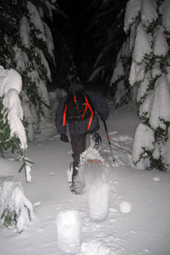
There were few distinguishing features in the darkness. The road did a few minor twists and turns, but for the most part stayed in the trees with no views. The clouds prevented any light, but we were too far from the ski areas to reflect their lights. We were limited to a few short feet of snow lit up by our headlamps.
At a signed intersection (the sign said Road 4936 120) we turned away from the tracks, but the road seemed to head down, not up like we were hoping. We abandonned the downhill road and bushwhacked through some trees to regain the real road. (Of course, it was the abandonned road that we really wanted.)
We followed the road until we came to a sharp switchback where the snowmobile tracks turned to the left and a road with fresh snow continued straight. We went straight and started breaking trail. Compacting the snow really slowed us down, but gave me an opportunity to look around at the trees and the animal tracks that criss-crossed the road.
There were oodles of rabbit tracks and something we figured must be a deer. There were even a few tiny tracks that must have been mice, but of course it's hard to say for sure.
After an hour and a half with nothing to show for it we called it quits. The GPS gave us an elevation, but since I hadn't calibrated it at the road I wasn't sure if it was our true elevation. Because we had changed plans at the last moment I didn't have the route for this road on the GPS so we were really operating only by map and compass. It looked like we'd gone a lot farther than planned, but surely that couldn't be the case.
We headed downhill and made excellent time. Dan called out the time at various waypoints (like road intersections and turns) and it seemed we were very fast. We're usually faster going down, but this was even more disparate. We had spent an hour and a half going up and it took about 40 minutes going down.
In spite of the snowmobile usage the road merits a further look. Only 1.5 miles and another 1,000 feet of gain beyond our stopping point is Baker Lake and although we really couldn't see much there were a few openings in the trees that had promise.
After downloading the GPS data it was clear to see we had gone farther than we thought. The total distance was 4.8 miles with 1,000 feet of gain.