Back in May I hooked up with the TNAB crew for a hike up Bandera Mountain. Since then I did Pratt Mountain, Granite Mountain, Tinkham, Abiel, and Silver Peaks, Putrid Pete's Peak, Tinkham Peak (again, but from the east this time), and Rampart Ridge.
Although I missed a couple over the course of the season it was a pretty good run. Unfortunately, the season has to come to an end because it's just not possible to leave the trailhead at 6pm and get anywhere worthwhile before it's dark. The last real hike on the schedule was Guye Peak, the solid rock pinnacle I-90 heads straight at before turning east just before Snoqualmie Pass.
Guye Peak has a couple of summits. The official summit is at 5,168 feet. The trailhead for the unofficial trail (right next to the official Snow Lake trailhead) is at 3,143 feet. A little math shows that we're talking about 2,000 feet of gain. Since the trail isn't blessed (cursed?) with the Forest Service's penchant for well-graded switchbacks it promised to be a quick, brutal climb.
I got to the trailhead just before 6pm and saw just Mark, the TNAB leader, standing by his car. As I got out Don entered view. The rain (and snow on Mt. Defiance and Snoqualmie Mountain) and lack of respect for Guye Peak had kept everyone else away.
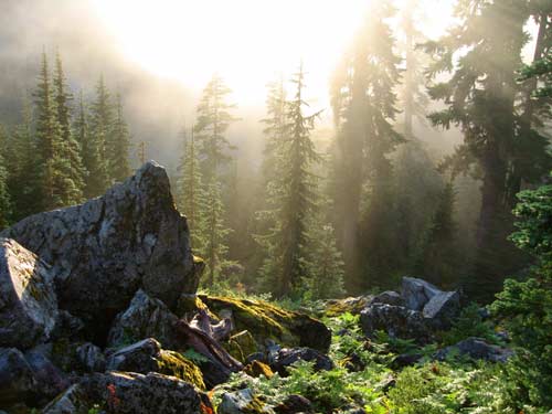
It had been raining hard for the last day or so and the brush bordering the narrow trail was soaked. As we made our way up the steep, rooty, rocky trail the brush dumped their water on us. Even though it wasn't actually raining the effect was the same.
About a third the way up we broke out of the trees onto a talus field. A sign pointed to the right to Guye Peak and to the left for Snoqualmie Mountain. TNAB had done two trips up Snoqualmie this season so although I would have been tempted to head that way we bore to the right up Guye Peak.
Mark and I were a short way ahead of Don when we came to an apparent split in the trail. We figured on the high road (my choice), but quickly became less than convinced this was correct. Downslope, Don corrected us and we were back on our way.
As the trail leveled out at the ridge we passed a nasty little tarn and came to an intersection of trails. A trail disappeared over the ridge down to the Commonwealth Basin and another ran north and south along Cave Ridge. Cool. As we started to pull away from Don again he indicated he would be going to only the first summit, not the true summit. Ok. Whatever. See you at the top.
Another short, steep climb and we were walking through heather and blueberries as the sun was setting over the mountains to the west. We hurried up the last 100 feet of elevation and looked toward the true summit... across a chasm that might as well have reached the center of the earth. No way were we going this way.
We climbed down and looked to the east. That didn't go. How about a little lower? Nope. Don was catching up and pointed us to the west side. There was a sketch of a trail around the north summit, but it quickly ended. Mark scrambled up and looked over. "I think it could work." Uh huh. No way was I going that way. He relented and returned.
Don commented that he had indeed gone that way, but dang. High exposure, wet rocks, at night? Not tonight. And that's not my thing so I'm happy to have checked off Guye Peak on the north summit, even if it was a few feet lower than the true, south summit. (Mark wasn't so accepting. He was bothered by the "failure" all the way down.)
The trip down was pretty uneventful. We had headlamps on as soon as we entered the trees and slipped and stumbled our way back to the cars. Definitely a good trip and one that will probably be featured on next year's TNAB schedule.
Since the trail doesn't exist on any maps and I didn't have the GPS tracking I don't know the actual distance of the trail, but it felt like about two miles. It's about 2,000 feet of gain from the trailhead to the south summit and it took just over an hour to get there in spite of some picture opportunities and a couple of route finding adventures.