Last week after our epic trip up Fuller Mountain we pondered the next destination. "How about Mt. Washington?" I heard. "Lame!" I declared. "We just did that. How about that peak just the east that the old trail goes around before the Great Wall?" "You mean Change Peak?" "I dunno, but we could go up the Change Creek Trail. It's pretty TNABby."
In fact, the Change Creek Trail is perfect for TNAB. It's been almost four years since I've been up that way. I've heard the steep trail has only gotten better in the meantime, but even with a nasty forecast and rising avalanche danger it would be a good fit.
So on this fine April morning I scraped the snow and ice off the windshield (seriously), survived a snowy drive to the bus (seriously), had a remarkably dry walk up the hill (surprisingly), worked my way through the day (not surprisingly), got a ride home with Nana (I'm a ticket to the carpool lanes), and then braved curtains of hail and snow to make it home. EPIC! And I haven't even set foot on the trail yet. Since it's Spring Break (Can't you tell from the weather?) there's no swimming or ballet or anything else so I took the truck to the trailhead a few miles up the freeway. The freeway was ok, but the side roads were nasty. Amy was worried it'd be just me and a few others, but we had a decent turnout of about 12 idiots willing to brave the elements.
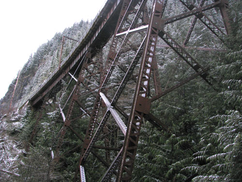
The route wasn't actually to Change Peak, or maybe it was. Nobody was really that sure which one Change Peak was. Regardless, we were going up the Change Creek Trail to the high points on the ridge without following the route I had originally proposed. After the quick and scenic walk up the climber's trail along Change Creek we followed the Iron Horse for a few 100 feet, over a trestle, dropped layers (silly fleece making me all hot), and then onto the switchbacks.
A renegade trailbuilder called "Whitebark" has been building the Change Creek Trail for a couple of years and it's to the point where it's a pleasure to walk on. We had snow (the consistency of powdered sugar, but colder) from the cars, but once on the trail it started getting deeper. The trail is designed so switchbacks occasionally give you a view over the valley (and the most beautiful freeway ever!), but don't let you forget the goal is to gain elevation quickly.
Once on the ridge it mellows a bit and we followed through snow-covered beargrass and sallal. We marched on, past "Whitebark's Bivouac", past the intersection where I turned last time, and finally to Hall Point. I think. Nothing up there has official names so it's often difficult to know. So we'll call it Hall Point and be done with it. Great viewpoint. Dramatic cliffs. Not a lot of room. We looked up the slope and saw we had a LONG way to go to get to the top of the ridgeline. Better get moving.
The trail seems to have been neglected from this point on. Or just not built yet. So there was a lot of pushing through branches and spindly trees trying to reclaim the logging roads. Just after Hall Point we had to round a shoulder of rock that was nicely frosted and just dicey enough a few people turned back. They didn't miss much. Above the rocks the views didn't get much better, but at least it got windier.
Where we stopped to put on snowshoes we saw a couple of snowdevils form and spin for a while. Matt, our official TNAB weatherman (well, as official as anything TNAB is) described the forces behind the creation of the devils and took the magic right out of them. I still maintain they were made by the souls of harvested trees still angry at people after all these years.
We continued up the ridge, but were soon stymied. It was 8:00, our usual turnaround time, so the fact that the rocks ahead would be a bit more challenging than we were prepared for didn't bother us too much. We returned to the site of the snowdevils and gathered for a group photo. Timing is everything and just as we were all posed a wicked gust came from the west and threatened to take the camera right off the tripod.
We beat a hasty retreat, reunited with the hikers who were smart enough not to go past the rocks, and were soon back at the trucks with only a light rain falling.
Total distance: 3.64 miles, 2830 feet of gain.