Yeah, I know. We Northwesterners complain about the rain a lot, but have even louder, more annoying whines when it comes to high temperatures. For me, that means anything over about 75F. So after a few days of 100F+ in Seattle (seriously, it felt like 1000F walking along the sidewalk in casual business attire and don't get me started about the lack of air-conditioning on some of the older buses) I was about done with the heat.
The plan was to go to the concert with the kids and skip TNAB. However, Amy decided that given an early departure for Portland in the morning, the lack of A/C at the house (it still never got above 76F inside as far as I can tell), and the fact that our kids aren't smart enough to stop running around when it gets that hot we elected to cancel on the concert. It was kind of a last minute decision, but that just meant I'd have to be super-speedy to get to the trailhead at Snoqualmie Pass on time.
While it was brutal hot in Seattle and freaking hot at home it was only moderately hot at the Guye Peak trailhead. (87F, 30% humidity) The first time I tried for Guye in 2006 we didn't know how to get from the first summit to the second or third summits. In 2008 we had experience and perfect weather for the summit. Both of those trips were in September. (Guye was moved up in the schedule this year because it's short and seemed a better choice than a long trip even if that long trip would wind up at a lake.)
There were only three of us at the trailhead (me, Steve, and Chris) so we weren't the usual string of thousands heading up the steep trail. I tried to drink and drink and still felt like I wasn't drinking enough. By the time we got to the split to Snoqualmie Mountain (another low-attendance TNAB, though that was due to cold and wet weather) I'd already downed two liters of water. No worries, though, I had another 1.5 in the pack and nuun tabs to spice them up.
At the tarn we apparently passed Don who had experienced some navigational issues, but I never saw him there. We knew at least Scott was waiting for us higher up (his truck was in the lot) so we pushed on with usual TNAB tenacity and found Scott and Tisha at the top of the gully having already tagged the first summit. After briefly touching the top rock we came back down for the scramble to the next two summits. (Don caught up at this point, but was apparently too out of breath to tell us to wait so he could join us. He stayed on the first summit.)
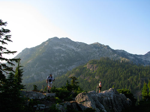
The gully descent seemed easier this year, perhaps because there were only five of us. Although Chris strung a hand line back up to the second summit we didn't bother to use it. A quick reminder that the easiest route is over the second summit and we were on the steep scramble down toward the south summit, which may or may not be the real summit, but is definitely the one with the most room for pictures.
We took pictures of us, of Don, of the mountains, the hot, cloudless sky, blah blah blah. Lots of pictures. (Well, duh.) The sunset wasn't like I remembered, probably because it was a lot longer before dark than when we usually hike Guye in September. Don disappeared from his summit and since we didn't see a body below we figured he must have headed down. We used the hand line on the way back, but it was more a balm for the mind than anything else. Nothing to report on the way down except we got out before it was dark so no headlamps this trip.
Total distance: 2.5 miles and 2,400 feet of gain.